There are a LOT of natural arches in the Las Vegas area; whereas natural bridges are MUCH more rare in this part of the country. The difference between a natural bridge and a natural arch is that a bridge is formed by running water and an arch is formed by chemical and physical weathering. Once formed, however, they both enlarge by similar processes. We found one of those rare natural bridges on a tributary to the Colorado River a few miles below Hoover Dam.
 Our
hiking group did a tour of the Techatticup gold mine in Eldorado canyon near
Nelson, NV. It was unusual weather for the desert and the clouds hung low
over the mountains making this remote place seem all the more ominous. That
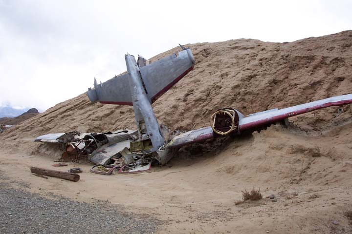
feeling was validated when we passed the wreckage of a small
plane. We were relieved to learn that it had been brought there for use
as a movie prop. In keeping with the practice of rural people everywhere,
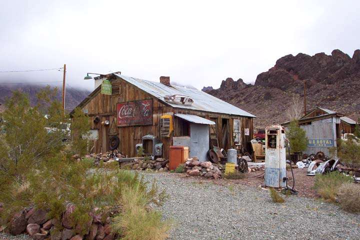
nothing of potential value was ever thrown away. We found a treasure trove
of "artifacts" all over the place.
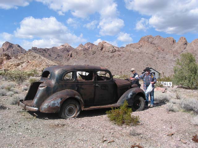
The old cars were the most interesting.
Our
hiking group did a tour of the Techatticup gold mine in Eldorado canyon near
Nelson, NV. It was unusual weather for the desert and the clouds hung low
over the mountains making this remote place seem all the more ominous. That
feeling was validated when we passed the wreckage of a small
plane. We were relieved to learn that it had been brought there for use
as a movie prop. In keeping with the practice of rural people everywhere,
nothing of potential value was ever thrown away. We found a treasure trove
of "artifacts" all over the place.
The old cars were the most interesting.
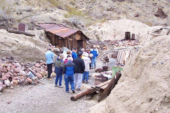 Our
tour guide was excellent. He began by telling us how the (almost) ghost town
of Nelson had been the largest town in southern Nevada for nearly 50 years,
until the coming of the railroad in 1905. He told stories about renegade Indians
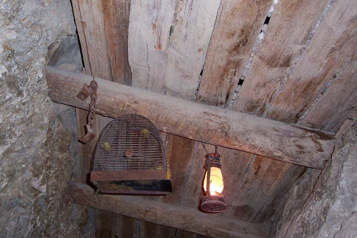
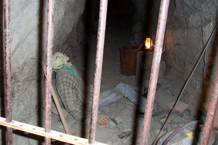
and no-nonsense sheriffs; about jumped claims and general lawlessness. Inside
the mine were authentic lanterns and even a (sacrificial) canary
cage. In one corner they displayed a hapless miner
who attempted to pack blasting powder in a drill hole using his metal drill.
A spark drove the drill back through his forehead.
Our
tour guide was excellent. He began by telling us how the (almost) ghost town
of Nelson had been the largest town in southern Nevada for nearly 50 years,
until the coming of the railroad in 1905. He told stories about renegade Indians
and no-nonsense sheriffs; about jumped claims and general lawlessness. Inside
the mine were authentic lanterns and even a (sacrificial) canary
cage. In one corner they displayed a hapless miner
who attempted to pack blasting powder in a drill hole using his metal drill.
A spark drove the drill back through his forehead.
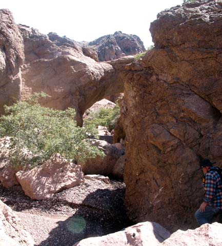 Naturally,
we asked about hiking in the area. Our guide told us about a Natural Bridge
near the top of Techatticup wash. How could we pass that up? I immediately
went home and consulted my topo software. Near the crest of a mountain range
to the south of Boulder City the software showed a feature called "Bridge
Spring". It was right at the head of the canyon that leads to the mine.
This HAD to be it! I copied down the approximate coordinates and a group of
us programmed our GPS's and set out to claim the prize.
Naturally,
we asked about hiking in the area. Our guide told us about a Natural Bridge
near the top of Techatticup wash. How could we pass that up? I immediately
went home and consulted my topo software. Near the crest of a mountain range
to the south of Boulder City the software showed a feature called "Bridge
Spring". It was right at the head of the canyon that leads to the mine.
This HAD to be it! I copied down the approximate coordinates and a group of
us programmed our GPS's and set out to claim the prize.
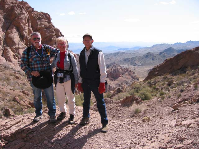
In order to make the hike more challenging, we decided to park a shuttle car down at the the mine and try to hike the length of the canyon. Surveying our route from the top gave no hint of the obstacles below. We only ran into one real show stopper, but were able to detour up and over through side canyons. When we reached the bottom of the canyon, we were surprised to see that the distance had been just over 4 miles. It seemed like 10!