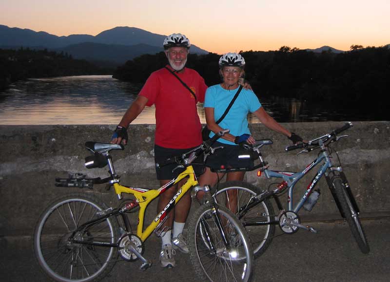
 On our way north to meet some friends at Mount Shasta, we stopped overnight
at the Redding Elks Club. It was so nice that we ended up staying there for
a whole week. We arrived during a freak hot spell when one day it actually
hit 120 degrees! That Elks Club has a bigger than Olympic size swimming
pool which helped to take the edge off the heat. It is also situated right
on the Sacramento river with eight miles of paved bike
trails on both sides of the river.
On our way north to meet some friends at Mount Shasta, we stopped overnight
at the Redding Elks Club. It was so nice that we ended up staying there for
a whole week. We arrived during a freak hot spell when one day it actually
hit 120 degrees! That Elks Club has a bigger than Olympic size swimming
pool which helped to take the edge off the heat. It is also situated right
on the Sacramento river with eight miles of paved bike
trails on both sides of the river.
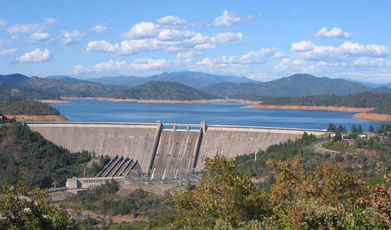
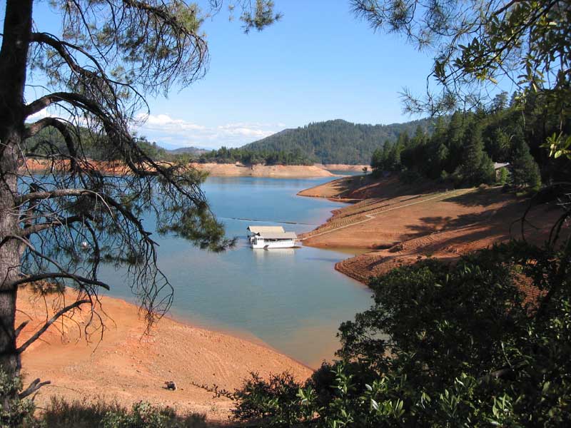
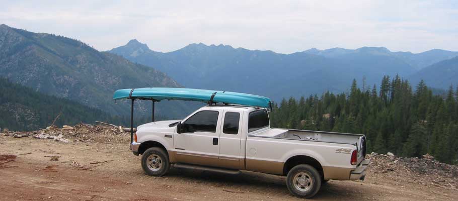
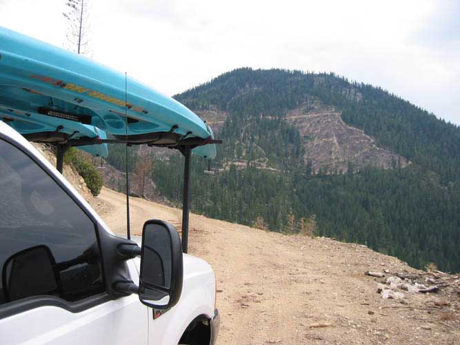
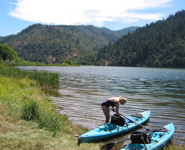 The city of Redding is right in the heart of the Shasta, Trinity, Whiskeytown
National Recreation area. Lake Shasta is really
low this year, so we decided to do our kayaking
in the other two lakes, Lewiston (on the Trinity River) and Whiskeytown. Interestingly
the water from Lewiston lake is piped over the Trinity Divide into Whiskeytown
lake which ultimately runs into the Sacramento river and supplies water to
California's central valley instead of following the Trinity, which runs unused
into the Pacific ocean near the Oregon border.
The city of Redding is right in the heart of the Shasta, Trinity, Whiskeytown
National Recreation area. Lake Shasta is really
low this year, so we decided to do our kayaking
in the other two lakes, Lewiston (on the Trinity River) and Whiskeytown. Interestingly
the water from Lewiston lake is piped over the Trinity Divide into Whiskeytown
lake which ultimately runs into the Sacramento river and supplies water to
California's central valley instead of following the Trinity, which runs unused
into the Pacific ocean near the Oregon border.
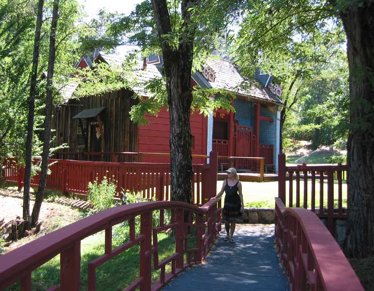
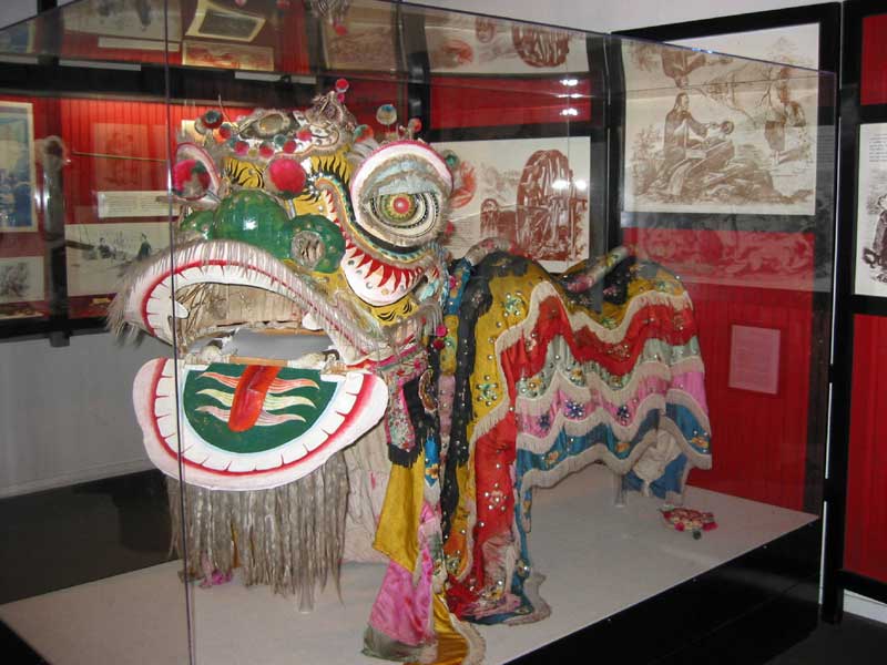 Weaverville is a small town just across the Trinity Divide from Redding.
The town was originally founded by Chinese gold miners. We were watching Hewell
Houser's California Gold one night, and there he was, in Weaverville at the
Joss House state park. It is an old Chinese temple
that we just had to drive out and see for ourselves. Bob took one of his famous
"short cuts" on the way home and we ended up crossing the mountain
on a series of narrow dirt logging roads. To his
credit, he did stop to ask directions. A ranger told him that the roads intertwine
and were not well marked. She said that people get lost in there and "sometimes
don't get out for days". We drove it anyway and shouldn't have been surprised
when, two hours into our (supposed) 27-mile route, we finally came to a wide
dirt road and a sign telling us we still had 15 miles to go!
Weaverville is a small town just across the Trinity Divide from Redding.
The town was originally founded by Chinese gold miners. We were watching Hewell
Houser's California Gold one night, and there he was, in Weaverville at the
Joss House state park. It is an old Chinese temple
that we just had to drive out and see for ourselves. Bob took one of his famous
"short cuts" on the way home and we ended up crossing the mountain
on a series of narrow dirt logging roads. To his
credit, he did stop to ask directions. A ranger told him that the roads intertwine
and were not well marked. She said that people get lost in there and "sometimes
don't get out for days". We drove it anyway and shouldn't have been surprised
when, two hours into our (supposed) 27-mile route, we finally came to a wide
dirt road and a sign telling us we still had 15 miles to go!
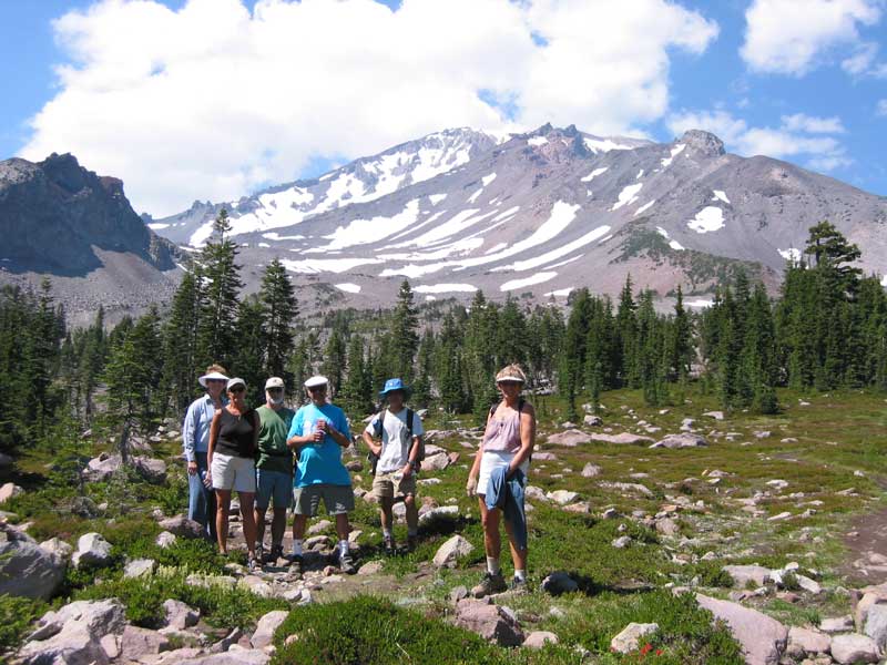
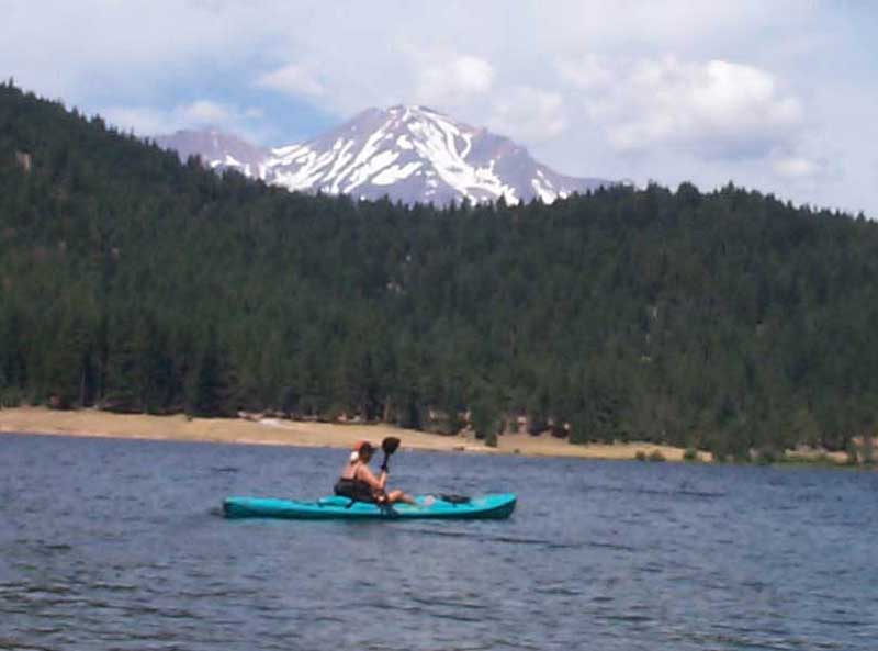 We met up with our friends in the town of Mount Shasta. As soon as we arrived,
we detoured to go kayaking in Lake Siskiyou, which is the headwater of the
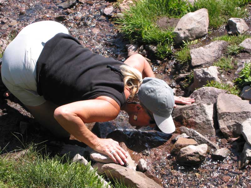
Sacramento river. Up on the mountain we hiked to a "sacred spring"
where Patty and Joan had to drink from the "sacred"
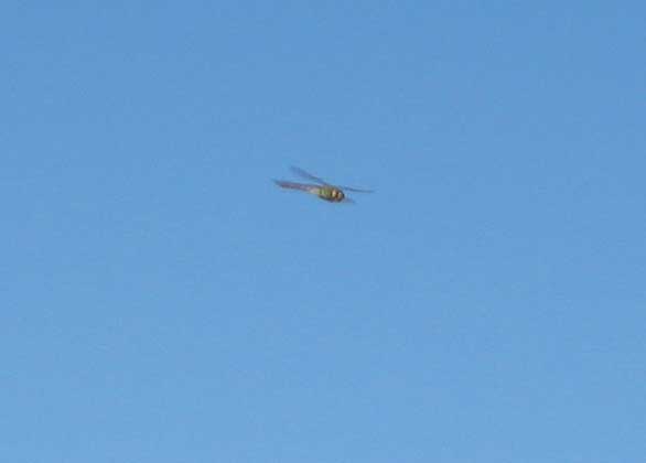
waters. A sign on the trail told us to watch for wildlife,
but all we saw was a dragon fly trying to imitate a helicopter.
We met up with our friends in the town of Mount Shasta. As soon as we arrived,
we detoured to go kayaking in Lake Siskiyou, which is the headwater of the
Sacramento river. Up on the mountain we hiked to a "sacred spring"
where Patty and Joan had to drink from the "sacred"
waters. A sign on the trail told us to watch for wildlife,
but all we saw was a dragon fly trying to imitate a helicopter.
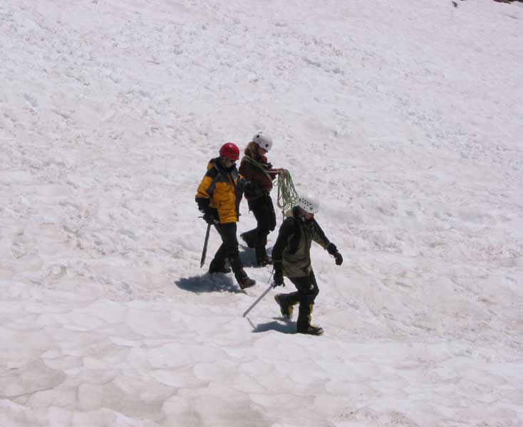
 Hiking Mount Shasta is a BIG deal. There is no real trail to the top and
the elevation gain is unnerving. Patty and I have hiked to the top of Mount
Whitney a couple of times. Whitney is 14,500' high; the trail is 11 miles
long and gains 6,000'. Shasta is "only" 14,110' high; but the route
to the top gains 7,100' in less than 6 miles. Much of the route is on snow
and ice so crampons and ice axes are a necessity.
Hiking Mount Shasta is a BIG deal. There is no real trail to the top and
the elevation gain is unnerving. Patty and I have hiked to the top of Mount
Whitney a couple of times. Whitney is 14,500' high; the trail is 11 miles
long and gains 6,000'. Shasta is "only" 14,110' high; but the route
to the top gains 7,100' in less than 6 miles. Much of the route is on snow
and ice so crampons and ice axes are a necessity.
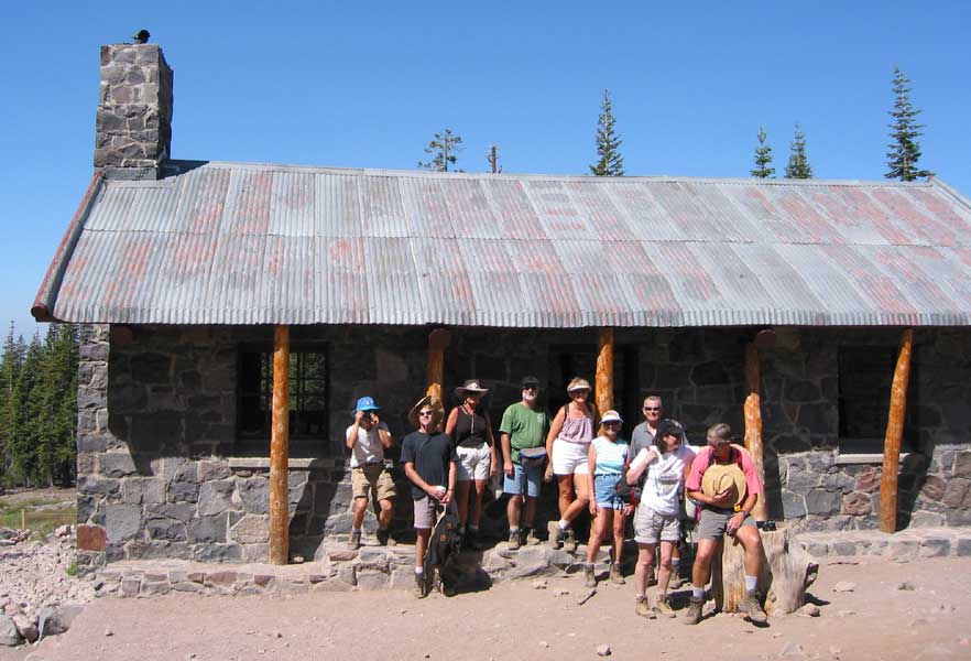
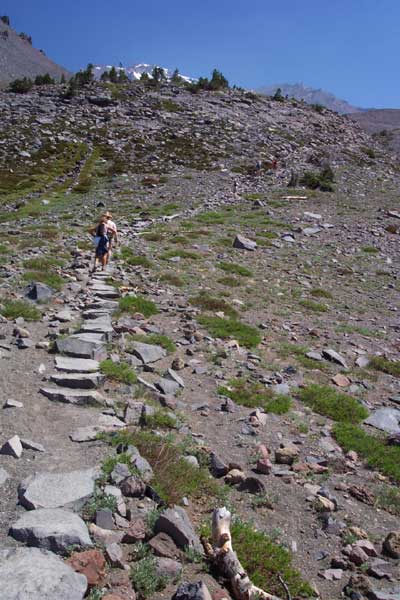
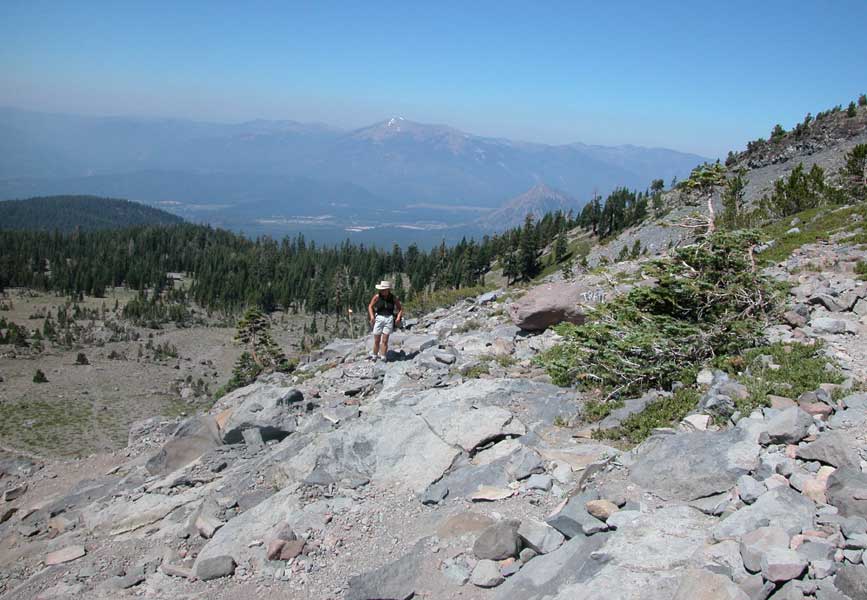
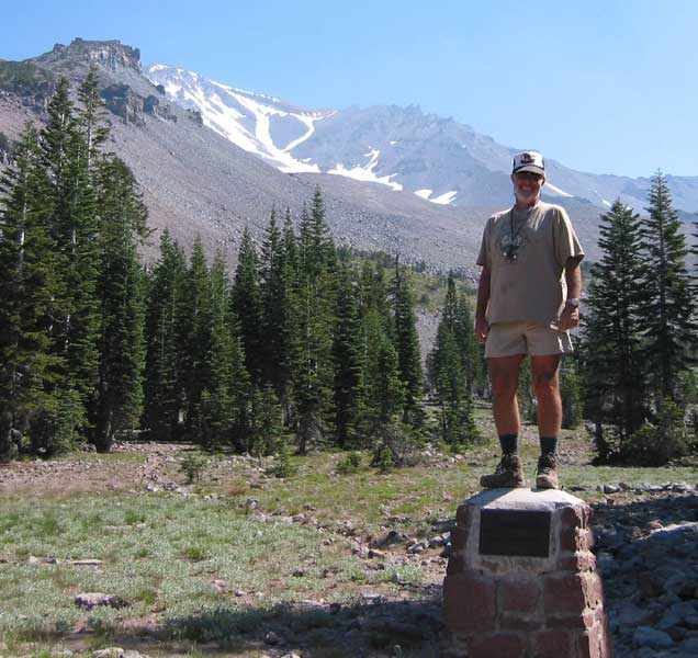 The first mile and a half gains 1,000' to the Sierra Club hut
at Horse Camp. The next mile gains another 1,000' with most of it following
a trail of raised stones laid down in the 30's.
At this latitude you cross the tree-line at
about 8,500'. The next mile gains a whopping 1,500' to Helen Lake at 10,400'.
On the way, we looked around and decided that we were definitely underdressed!
The first mile and a half gains 1,000' to the Sierra Club hut
at Horse Camp. The next mile gains another 1,000' with most of it following
a trail of raised stones laid down in the 30's.
At this latitude you cross the tree-line at
about 8,500'. The next mile gains a whopping 1,500' to Helen Lake at 10,400'.
On the way, we looked around and decided that we were definitely underdressed!
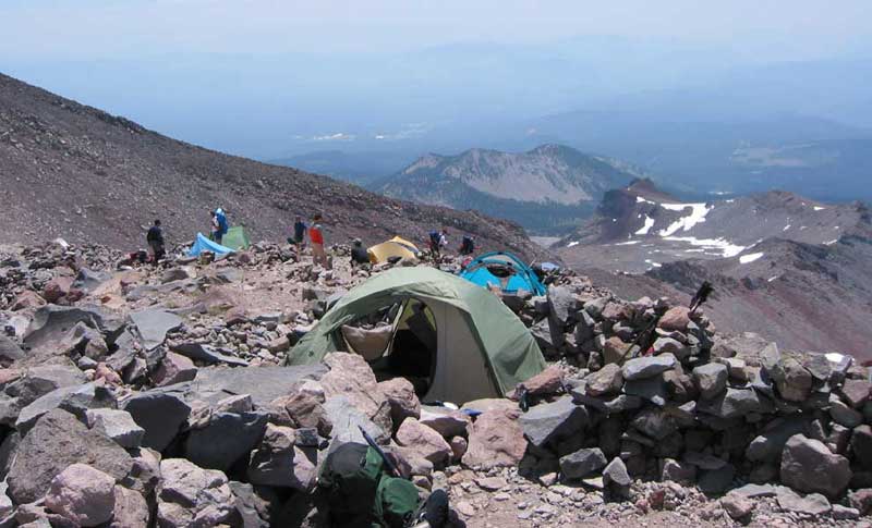 Helen Lake has no water; it is a small cirque valley that is filled with
snow even in late July. This is the base camp for hikers planning to do the
final two miles and 3,700' gain to the top. We used to think that 1,000 feet
to the mile was steep (20% grade); we now have a new definition of STEEP!
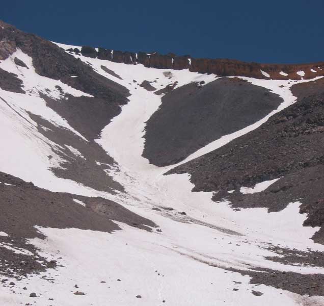
We were talking with some guys at base camp who told us that the climb is
hard but the decent is easy. They slide 2,000 feet or so down the trough
in the center of this photo, using their ice axes to keep from getting out
of control.
Helen Lake has no water; it is a small cirque valley that is filled with
snow even in late July. This is the base camp for hikers planning to do the
final two miles and 3,700' gain to the top. We used to think that 1,000 feet
to the mile was steep (20% grade); we now have a new definition of STEEP!
We were talking with some guys at base camp who told us that the climb is
hard but the decent is easy. They slide 2,000 feet or so down the trough
in the center of this photo, using their ice axes to keep from getting out
of control.