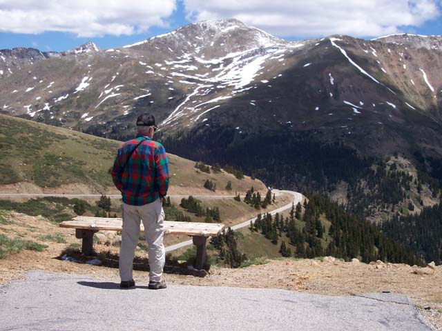
 One
of our first side trips took us over Independence Pass and through the famous
ski town of Aspen. Our first impression of the Colorado Rockies was how rounded
they looked compared to the jagged peaks of the Canadian Rockies or the Grand
Tetons. The Colorado peaks may be higher, but they are apparently older and
have had more time to erode.
One
of our first side trips took us over Independence Pass and through the famous
ski town of Aspen. Our first impression of the Colorado Rockies was how rounded
they looked compared to the jagged peaks of the Canadian Rockies or the Grand
Tetons. The Colorado peaks may be higher, but they are apparently older and
have had more time to erode.
One objective of this trip was to take a jeep trail to an oft photographed old mill that we first saw displayed at a Henderson art festival. This was our first experience with Colorado backroads and we quickly learned that there is a BIG difference between a "4WD road" and a "jeep trail"! Our full-size, long wheelbase truck doesn't fit on narrow jeep trails; a real disadvantage when you're looking at sheer 500' drops! We passed a sign saying "4 Wheel Drive Required" and the road started to get rocky and rough. I thought "this is doable". Then the road turned down a steep hill and got narrower by the minute. The driver's side was scraping the cliff wall on one side and the other side dropped off to eternity. Patty opened to door to see how much road was left and found herself looking straight down into the void! We couldn't get out of the truck! Backing up was not an option so we inched along until we reached the bottom and could drive into the creek and turn around. Going back up was just as harrowing. We later read that this road is rated as the most dangerous jeep trail around. Seven people died going over a cliff on that road last year! Patty had no trouble extracting a promise from me to avoid (most) similar situations in the future.
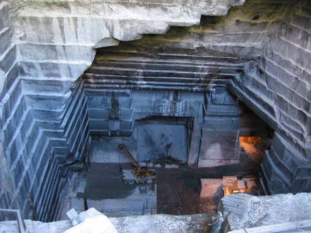
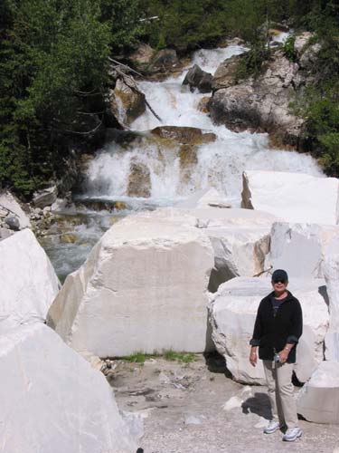
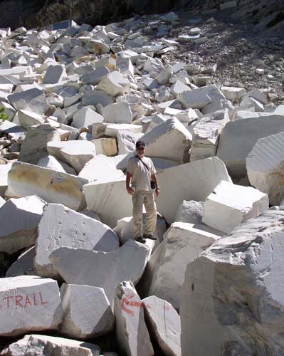 We
found a safe dirt road and followed it to a marble
quarry. A sign at road's end offered to let us take all we could carry
at no charge. The catch was that each block weighed many tons and you would
have to carry it at least 1/2 mile along a narrow
trail to your car! The stone being quarried here is the purest white
marble in the world. The headstone at the Tomb of the Unknown Soldier
came from here. We took their "free marble" offer to heart and pocketed
a few small chips as souvenirs.
We
found a safe dirt road and followed it to a marble
quarry. A sign at road's end offered to let us take all we could carry
at no charge. The catch was that each block weighed many tons and you would
have to carry it at least 1/2 mile along a narrow
trail to your car! The stone being quarried here is the purest white
marble in the world. The headstone at the Tomb of the Unknown Soldier
came from here. We took their "free marble" offer to heart and pocketed
a few small chips as souvenirs.
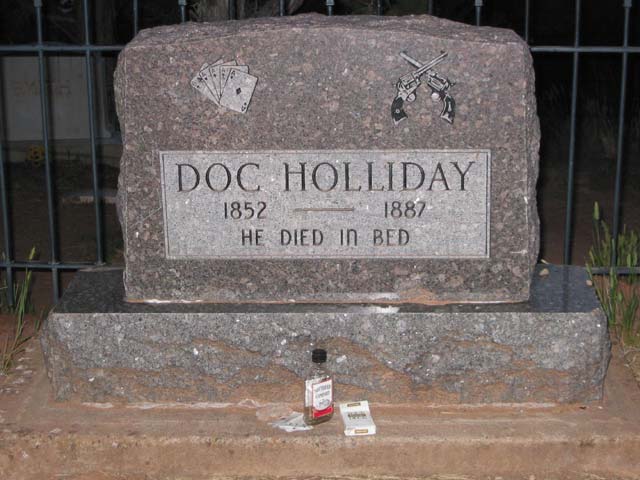
It was nearly dark by the time we arrived in Glenwood Springs. But, before we checked into a motel, we passed a sign for Doc Holliday's grave. Who could pass that up? A hiking trail led to the pioneer cemetery at the top of a hill. By the time we located his gravesite it was completely dark and we had to grope our way back down the hill.
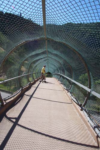
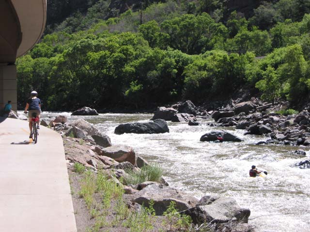
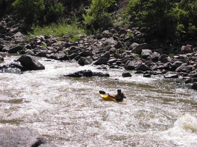
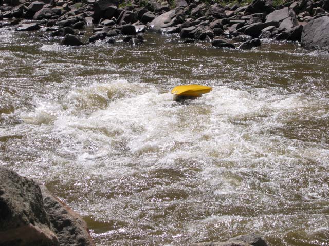
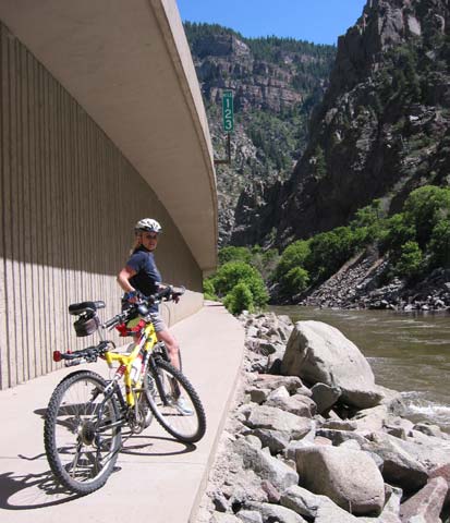 We
broke out the bikes and were crossing a bridge on the trail
first thing in the morning. Glenwood Canyon is quite narrow. The Colorado
River runs through it and leaves little room for anything else. Somehow the
engineers have stacked Interstate 70 (separate
east and westbound lanes), a railroad, and a bike trail alongside a river
full of kayakers. We stopped to watch them and one
guy managed to wipe out. As in: now you see him;
now you don't!
We
broke out the bikes and were crossing a bridge on the trail
first thing in the morning. Glenwood Canyon is quite narrow. The Colorado
River runs through it and leaves little room for anything else. Somehow the
engineers have stacked Interstate 70 (separate
east and westbound lanes), a railroad, and a bike trail alongside a river
full of kayakers. We stopped to watch them and one
guy managed to wipe out. As in: now you see him;
now you don't!
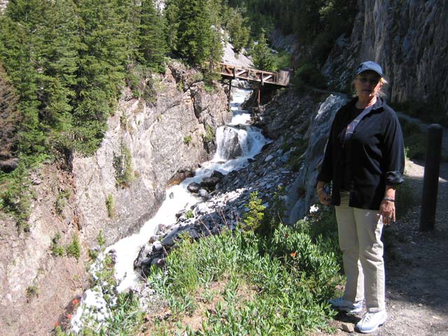
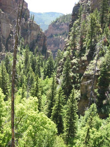
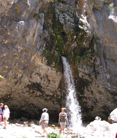
Our bicycling objective was riding to a hiking trail 11 miles upriver from our starting point. We parked our bikes and hiked a mile and a half up a STEEP and very narrow canyon to see Hanging Falls. A short "extra credit" hike took us to the source of the stream, a gushing spring that reminded us of Thunder River in the Grand Canyon.