We love exploring remote backroads and there is no place more remote than the Arizona strip. Five of us set out to find the remains of the Grand Gulch mine. It had once been the richest copper mine in Arizona employing about 75 men at the turn of the last century. The mine shaft timbers burned and the mine closed around 1918. The location is so remote, and the overland routes so inaccessible, that it has mostly been a destination for flying clubs. I found an excellent history of the mining operation in the on-line edition of an Aviator magazine at http://www.swaviator.com/html/issueas01/Gulch.html.
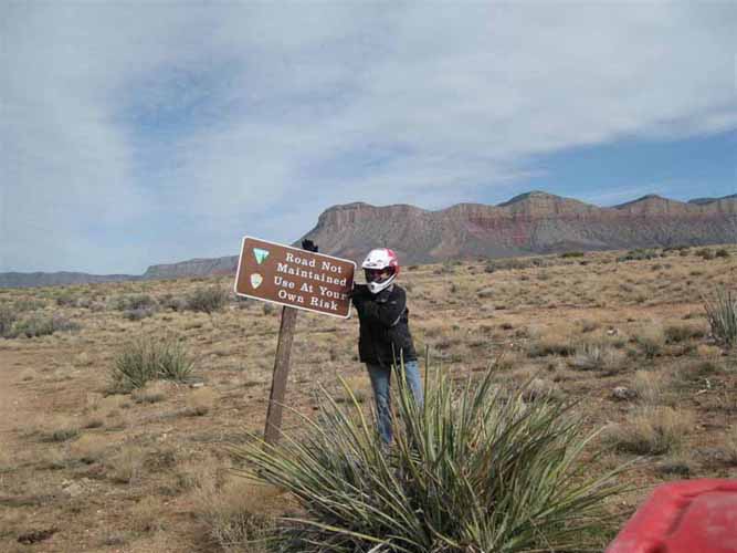
Perhaps more interesting (to me) than the mining operation are the "roads" that were followed in getting the ore to market. There are no street sign in the desert and mining roads were not designed to connect today's population centers. To get there I used my mapping software to identify decision points in the maze of roads/trails that blanket this otherwise empty area. See attached map. The result was (what I hoped would be) an 88 mile loop over moderate terrain. It didn't quite work out that way!
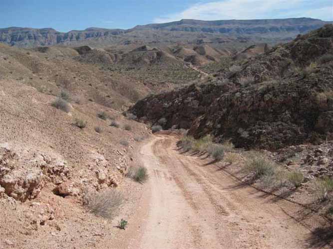
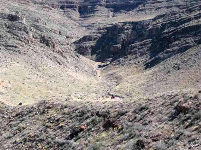
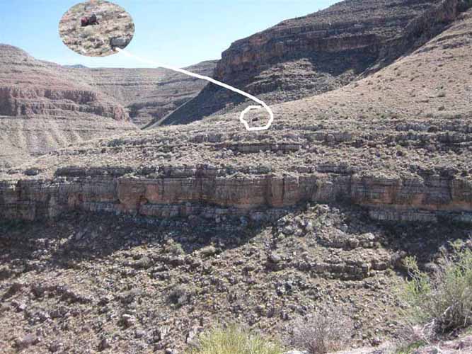
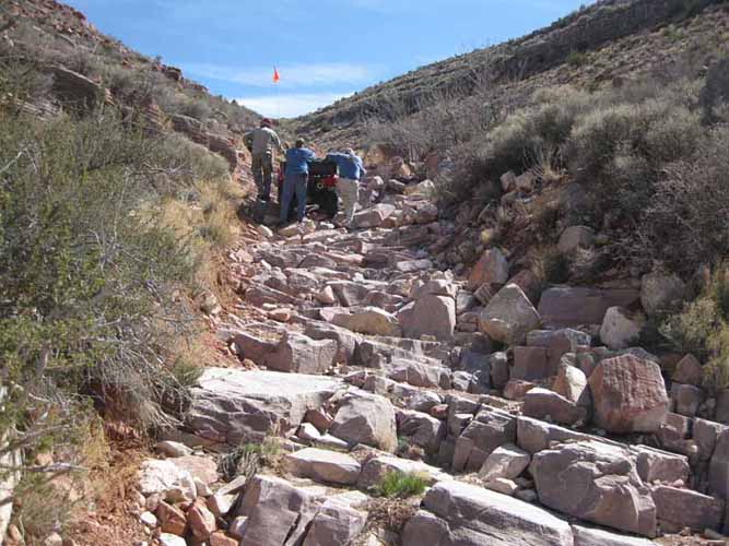
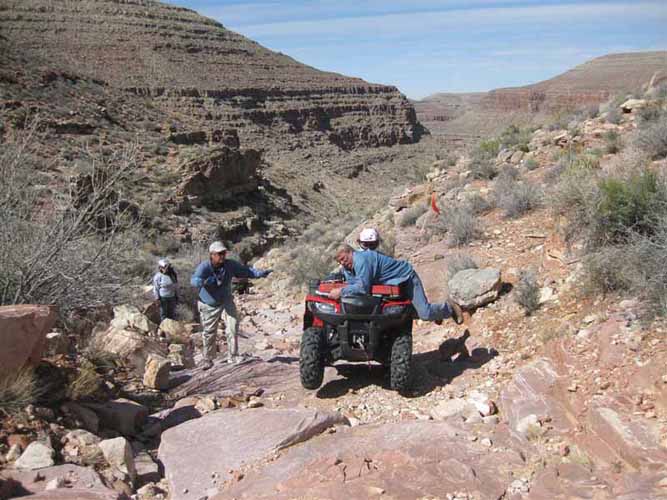
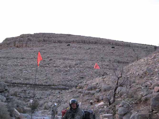
The first 20 miles were on (comparatively) high speed dirt roads. The quality of the roads/trails didn't deteriorate right away either. The next 15 miles took us up onto a bench, then back down through some narrow, meandering washes. Our route then climbed back up to the bench through another twisty wash, and crossed a hogback ridge leading into the mouth of what appeared to be a dead-end canyon. Our route through the canyon climbed steeply onto a pretty level road-cut that contoured for several miles along a 500 foot abyss. We were awe struck with the beauty of the canyon below but were more than a bit nervous with the sheer drop-off all along the way. We could see that the top of the mesa was still a couple of hundred feet above the road-cut but we were still naively trusting the road builders. Then we hit a half-mile long "stairway"! As soon as we saw it we decided to stop for lunch before attempting the climb. Vickie noted that riding the next section on a full stomach would just "give us more volume to throw up". We named it Vomit Hill.
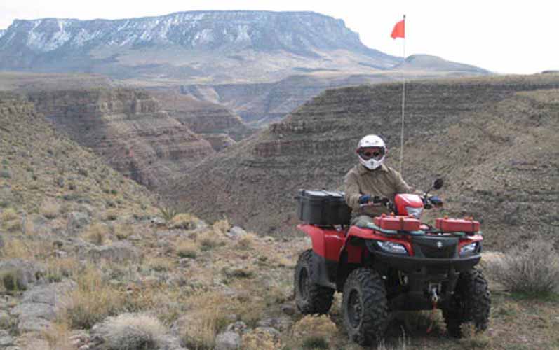
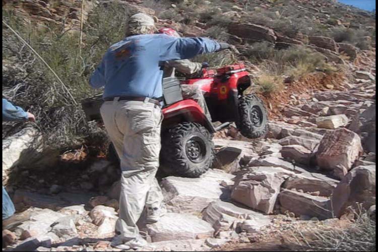
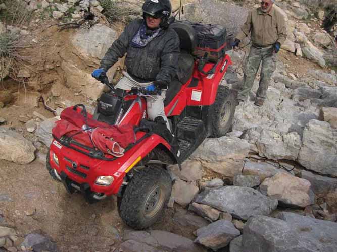
An ATV can take a lot of abuse and, in the hands of a reasonably skilled rider, can go up, down or across almost anything. The trick is weight distribution. If you put enough weight on the up-hill side, you might bounce but you (probably) won't turn over. We tested that theory to the max and still had a couple of machines end up with their tires pointing in a direction other than down. At one point we accidentally invented a new sport called "Rodeo Riding" (see Bob & Dave on YouTube).
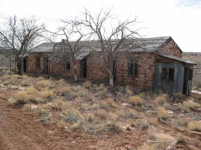
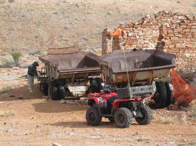
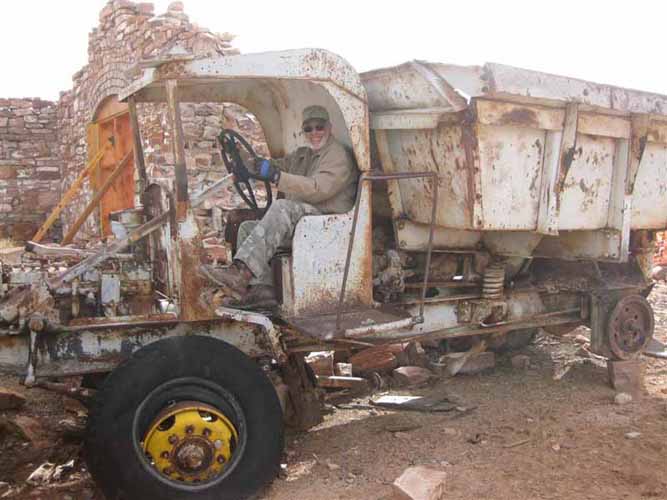
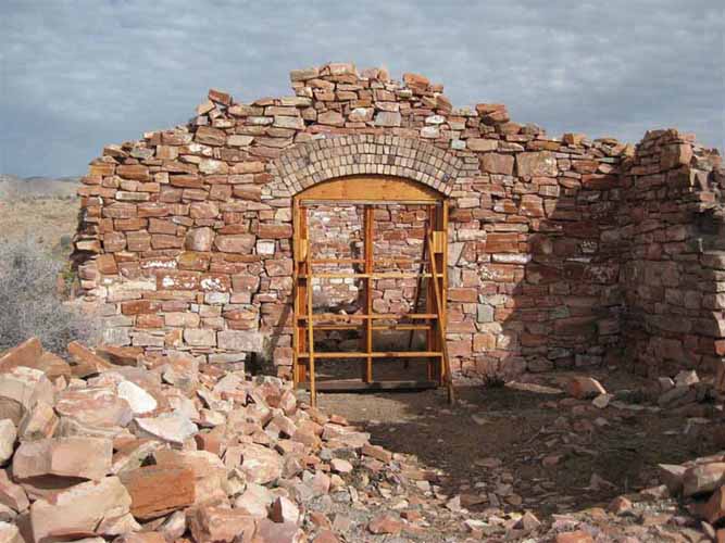
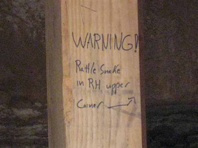
It took us more than 2 hours to go that 1/2 mile up Vomit Hill. At the top we found a sign laying on the ground that, when we picked it up, cautioned us not to go back down. We were now way behind schedule, having spent nearly 5 hours going the first 40 miles. But, from where we were, it was a short 5 mile jaunt to our destination at the mine. We took some time to explore the structures and equipment that the mine owners had abandoned so long ago. The neatest thing we found was a couple of 80 year old dump trucks with mechanical brakes and solid rubber tires. We could just picture ourselves behind the wheel. There was a bit of preservation underway where someone is attempting to shore up the beautifully constructed, (but now crumbling) stonework. That someone had also posted a warning sign at the entrance to one of the structures.
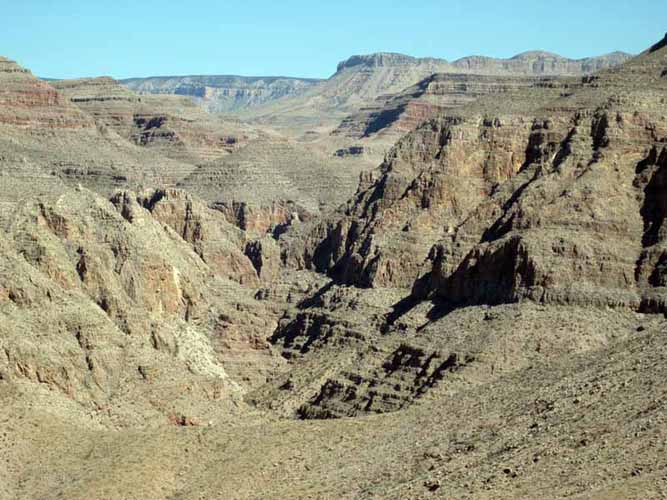
Leaving the mine site, we expected to find "good" roads leading back to camp. WRONG! The road through Grand Gulch canyon which (we now know) drops 1,500 feet in 3 miles was an obstical course. The passing years have not been kind to that "road"! It took us well over an hour to go 1/2 a mile down the canyon, sliding down significantly steeper steps than we had encountered on our trail up the mountain. At the time, however, we didn't know how far away the bottom was. All we knew was that there were (supposed to be) good roads at the bottom. With an hour of daylight left, Patty and Vickie hiked farther down while the men were winching the ATV's over one of the many dry falls. They came back with the horrifying news that we had a LONG way to go, and the trail below was even worse!
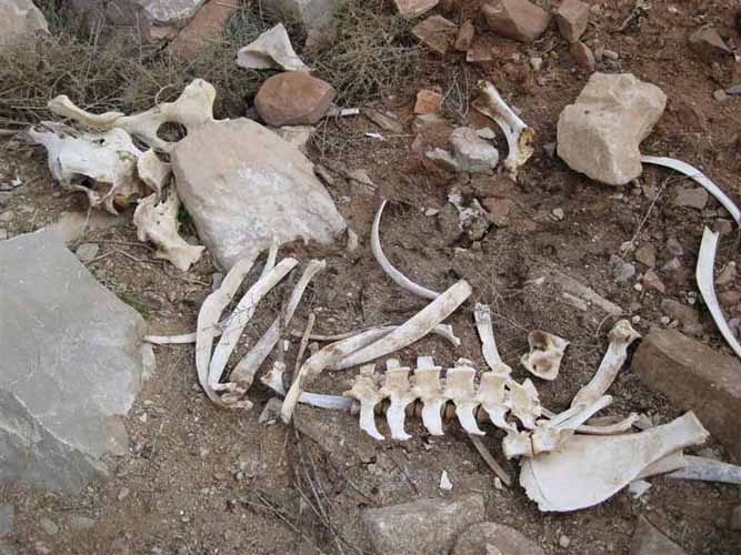
Here we were at the top of another 10 foot drop, at least 45 miles from camp, with about an hour of daylight left, and there were nearly impassable trails in every direction! As much as we dreaded going back down Vomit Hill and riding for miles along the abyss on a nearly moonless night, we now knew that the "road" we were on (and the trail ahead) was many times worse. We were beginning to hallucinate and thought we saw Mountain Cows clinging to the nearly sheer cliff face. Then we saw an ominous indicator and knew we were at the end of our trail. Turning around in the narrow, rocky wash required some winching, but the rocks we had stacked to "construct a road" when we were coming down the gully made the ride back up hazardous but doable.
By the time we reached the dreaded Vomit Hill it was pitch black. There was significant danger of rolling and damaging both body and machine. Over the worst stretches, the husbands would ride a few dozen feet down the steep and off-camber drops, then hike back up (over terribly uneasy footing) and ride the lady's bikes down. This was no place for heroics on their part! We breathed a collective sigh of relief when we reached the bottom of the staircase an hour later, then tried not to remember the 500 foot sheer drop that was inches away for the next several miles. Ultimately, we were able to follow our GPS tracks through the maze of canyons back to a "real" road. But even from there it was still a full hour's ride back to camp. We rolled in a 10:30PM after 14 grueling hours and 110 "adventurous" miles. Kevin remarked that it was, simultaneously, the worst ride he's ever been on and the best ride he's ever been on. We were lucky; the outcome could easily have been different.